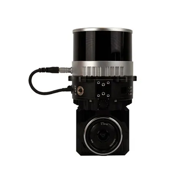
The processing platform contains a Wi-Fi interface, an embedded cellular modem for RTCM corrections, data logging tarkvara and a gigabit Ethernet network. Equipped with a high-performance INS, it delivers clean point clouds even at high AGL. As a small, lightweight and low-power system, it allows the user to fly longer, adapting to the needs of any project. The post-processing tarkvara provides fully automatic point cloud generation.
XFLY120 |
SÜSTEEM
SÜSTEEM vertikaalne täpsus (5m/s @50m) | ±3cm |
soovitatud AGL | 50-120m |
Kaal | 1.23kg (koos kaamera) 0.87kg (ei kaamera) |
mõõtmed | 20.8 x 14.8 x 15.2 cm |
Max lennuaeg (DJI M300) | 35 minutit |
väline hoiustamine | 256GB USB Kuulub |
LiDAR
Andur | Hesai XT-32M2X |
ulatus | 0.5-300m 80m @10% (kõik channels) |
ulatus täpsus | ±1cm |
FOV (horisontaalne) | 360° |
FOV (vertikaalne) | 40.3° |
Scan nurk (Vertical) | -20.8° kuni 19.5° |
Beam Divergence | 0.21°(H), 0.047°(V) |
Channels | 32 |
Returns | 3 |
Pulse kiirus | 640k/s (üksikvõte return) 1280k/s (Double return) 1920k/s (Triple return) |
GPS-AIDED INS
Constellations | GPS, GLONASS, BEIDOU, GALILEO |
väljund sagedused | kuni 200HZ (INS) Up yo 2000HZ (IMU) |
Pitch/Roll täpsus | 0.03 (RTK) 0.006 (PPK) |
Heading täpsus | 0.15 (RTK) 0.03 (PPK) |
Velocity täpsus | <0.03 m/s |
Position täpsus | 1cm+1ppm (RTK) 0.5 (PPK) |
KAAMERA
Model | ADTi 24MP RGB |
objektiiv | Sony E-kinnitus 16mm, 70° FOV |
max trigger kiirus | 2 sekundit |