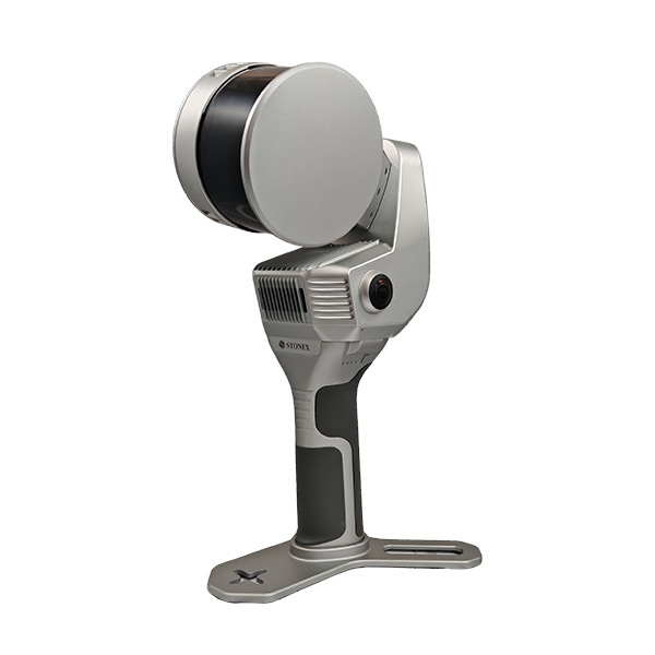
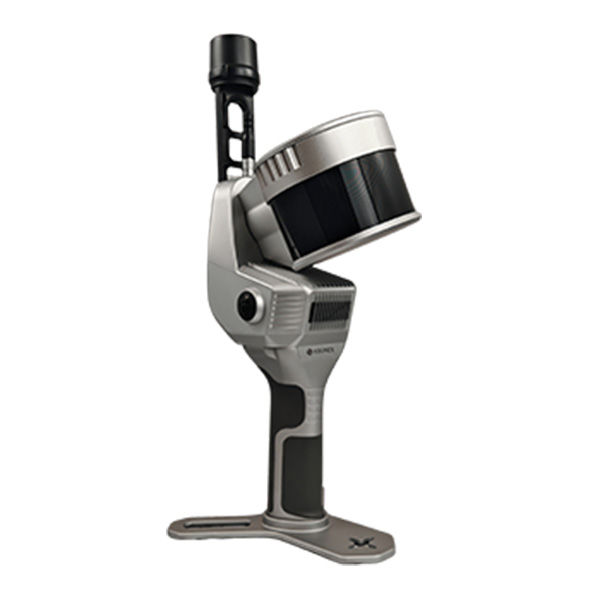
The system supports fast static scans in X-Whizz mode, which automatically align with the SLAM survey. A backpack, shoulder hook, car mount, and UAV mount for the DJI M350 are available to complete the setup.
X120GO v2 |
LIDAR
Max Range | 120 m |
Min Range | 0.5 m |
Return Number | 2 |
Scanning Point Frequency | 320,000 pts/s (single return) |
Field of View | 360° × 290° |
Laser Class | Class 1 eye-safe (IEC/EN 60825-1:2014) |
Channels | 16 |
Wavelength | 905 nm |
COLOR CAMERA
Number of pixels | 24 Mpx (2 cameras, 12 Mpx each) |
Diagonal FOV | 210° |
Focal length | 1.26 mm |
Resolution | 4000 x 3000 px |
Sensor size | 1/2.3 inch |
Pixel size | 1.55 μm |
GNSS RECEIVER
Satellites Signal | GPS L1 C/A L2P(Y) L2C L5 |
DGPS (RMS) | Horizon 0.4 m + 1 ppm |
RTK (RMS) | Horizon 0.8 cm + 1 ppm |
Speed accuracy (RMS) | 0.03 m/s |
SYSTEM
Relative accuracy | Up to 6 mm (environment dependent) |
Global accuracy | Up to 2 cm |
Control point support | Ground and wall |
Data storage | 512 GB SSD |
Communication | Wi fi, Bluetooth, USB type c, Lemo connector |
Operating mode | SLAM and X Whizz modes, real time visualization (colored and oriented) |
Processing mode | Real time processing, Post processing with GOpost |
ELECTRICAL SPECIFICATION
Power consumption | 26 W |
System supply voltage | 20 V |
Operating time | 1.2 h (single battery) |
External power | USB type c |
Battery input voltage | 5 to 20 V |
Battery output voltage | 10.8 V |
Battery capacity | 3000 mAh |
PHYSICAL SPECIFICATION
Weight | 1.6 kg (without battery), 2.1 kg (with battery) |
Size | 404 mm x 170 mm x 188 mm |
Operating temperature | minus 20°C to plus 50°C (minus 4°F to plus 122°F) |
Operating humidity | less than 95 percent |
Waterproof Dustproof | IP54 |
PLATFORM/EXTENSION
Extension | Support |
Backpack | Yes |
GNSS module | Integrated |
360° camera | Insta360 X4 X5 DJI Osmo360 |
Vehicle mount | Yes |
UAV | DJI M300 350 |
Radio Modem | Stonex SR02 |