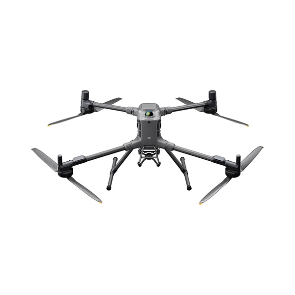
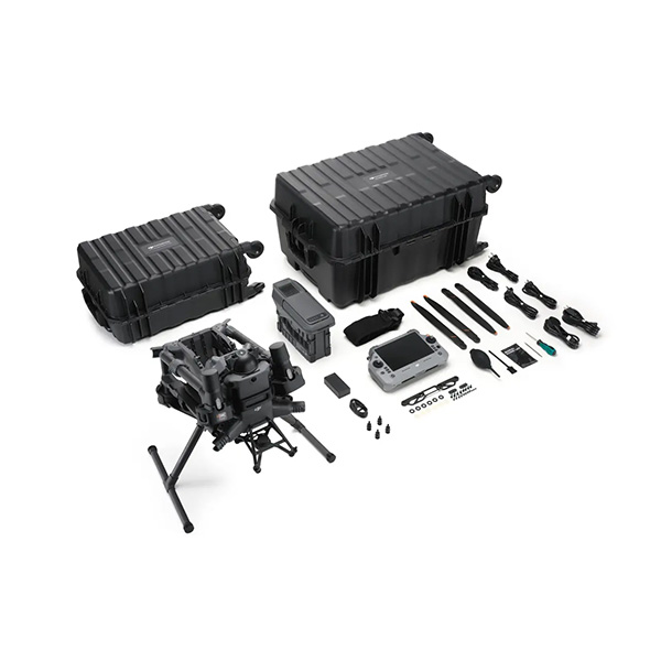
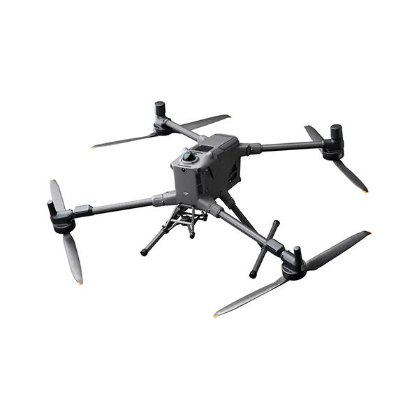
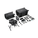
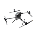
Matrice 400's flight capabilities are outstanding, offering up to 59 minutes of forward flight time even with a payload, and up to 53 minutes of hovering duration. These capabilities make it a reliable tool for long-duration and continuous operations such as search and rescue, firefighting, and large-scale mapping. It can also avoid large obstacles like buildings and mountains at flight speeds of up to 25 m/s.
MATRICE 400 |
AIRCRAFT
Takeoff Weight (with propellers) | Without Batteries: 5020 ± 20 g With Batteries: 9740 ± 40 g |
Max Takeoff Weight | 15.8 kg |
Dimensions | Unfolded: 980 × 760 × 480 mm (L×W×H) (with landing gear) Folded: 490 × 490 × 480 mm (L×W×H) (with landing gear and gimbal) Maximum dimensions excluding propellers. Aircraft carrying case: 779 × 363 × 528 mm (L×W×H) |
Max Payload | 6 kg (Measured at the third gimbal connector under sea level conditions. Payload capacity decreases as altitude increases.) |
Propeller Size | 25 inches |
Diagonal Wheelbase | 1070 mm |
Max Ascent Speed | 10 m/s |
Max Descent Speed | 8 m/s |
Max Horizontal Speed (at sea level, no wind) | 25 m/s |
Max Takeoff Altitude | 7000 m |
Max Flight Time (no wind) | 59 minutes (Measured at constant 10 m/s at sea level, carrying only the H30T (10,670 g), from 100% battery to 0%.) |
Max Hover Time (no wind) | 53 minutes (Measured hovering at sea level with H30T (10,670 g), from 100% battery to 0%.) |
Max Flight Distance (no wind) | 49 km (Measured at 17 m/s, sea level, without payloads, from 100% to 0% battery.) |
Max Wind Speed Resistance | 12 m/s (during takeoff and landing) |
Max Yaw Angular Velocity | Yaw: 100°/s |
Max Pitch Angle | 35° |
Operating Temperature | -20° to 50° C (–4° to 122° F) (without solar radiation) |
Global Navigation Satellite System (GNSS) | GPS + Galileo + BeiDou + GLONASS**GLONASS supported only when RTK module enabled. |
Hovering Accuracy Range (with moderate or no wind) | Vertical: ±0.1 m (vision), ±0.5 m (satellite), ±0.1 m (RTK) Horizontal: ±0.3 m (vision), ±0.5 m (satellite), ±0.1 m (RTK) |
RTK GNSS Accuracy | RTK Fix: 1 cm + 1 ppm (horizontal), 1.5 cm + 1 ppm (vertical) |
RTK Heading | Supports RTK heading with accuracy better than 2° |
Airborne ADS-B In | Equipped with standard airborne ADS-B In receiver and dual antennas, supporting reception up to 20 km |
Internal Storage | N/A |
Ports | USB-C Debug Port × 1: USB 2.0 |
Propeller Model | 2510F |
Beacon | Built into the aircraft |
Ingress Protection Rating | IP55 |
GIMBAL
Maximum Payload for Single Gimbal Connector | 1400 gIf exceeds 950 g, the gimbal damper lifespan will decrease from 1000 hours to 400 hours. |
Maximum Payload for Dual Gimbal Connector | 950 g |
Maximum Payload for Third Gimbal Connector | 3 kg for quick-release port, 6 kg for screw lock fastening |
Maximum Payload for Zenmuse L3 Gimbal Connector | 2100 gIf exceeds 1600 g, the gimbal damper lifespan will decrease from 1000 hours to 400 hours. |
SENSING
Sensing Type | Omnidirectional binocular vision system (surround view provided by full-color fisheye vision sensors) Horizontal rotating LiDAR, upper LiDAR, and downward 3D infrared range sensor Six-direction mmWave radar |
Forward | Measurement Range: 0.4–21 m Detection Range: 0.4–200 m Field of View (FOV): 90° (horizontal), 90° (vertical) |
Backward | Measurement Range: 0.4–21 m Detection Range: 0.4–200 m Field of View (FOV): 90° (horizontal), 90° (vertical) |
Lateral | Measurement Range: 0.6–21 m Detection Range: 0.5–200 m Field of View (FOV): 90° (horizontal), 90° (vertical) |
Downward | Measurement Range: 0.5–19 m The FOV to the front and rear is 160° and 105° to the right and left. |
Operating Environment | Forward, Backward, Left, Right, and Upward: Delicate texture on surface, adequate light. Downward: Ground must have rich textures and sufficient lighting (>20% reflectivity, e.g., walls, trees, people). |
Rotating LiDAR | Standard Measurement Range: 0.5-100 m @ 100,000 lux with 10% reflectivity target |
Upper LiDAR (3D ToF) | 0.5–25 m at night (reflectivity >10%)The FOV to the up and down is 60° and 60° to the right and left. |
Downward 3D Infrared Range Sensor | Measurement Range: 0.3–8 m (reflectivity >10%)The FOV to the front and rear is 60° and 60° to the right and left. |
mmWave Radar | Measurement Range for Power Line: 36 m for 12.5 mm steel-core aluminum stranded wire 50 m for 21.6 mm steel-core aluminum stranded wire FOV: ±45° (horizontal and vertical)mmWave radar function unavailable in some countries/regions. |
FPV CAMERA
Resolution | 1080p |
Field of View (FOV) | DFOV: 150° |
Frame rate | 30fps |
Night vision | Starlight Grade |
VIDEO TRANSMISSION
Video Transmission System | DJI O4 Enterprise Enhanced Video Transmission System |
Live View Quality | Remote Controller: 3-channel 1080p/30fps |
Operating Frequency and Transmitter Power (EIRP) | 902–928 MHz: < 30 dBm (FCC), < 16 dBm (MIC) 1.430–1.444 GHz: < 35 dBm (SRRC) 2.4000–2.4835 GHz: < 33 dBm (FCC), < 20 dBm (CE/SRRC/MIC) 5.150–5.250 GHz: < 23 dBm (FCC/CE) 5.725–5.850 GHz: < 33 dBm (FCC), < 14 dBm (CE), < 30 dBm (SRRC) |
Max Transmission Distance (unobstructed, free of interference) | 40 km (FCC) 20 km (CE/SRRC/MIC) |
Max Transmission Distance (with interference) | Strong interference (dense buildings, residential areas, etc.): approx. 1.5–6 km Medium interference (suburban counties, city parks, etc.): approx. 6–15 km Weak interference (open spaces, remote areas, etc.): approx. 15–40 km |
Max Download Speed | Standard Mode: 80 Mbps downlink Playback Download: < 25 Mbps Single-Channel Bitrate: ≤ 12 Mbps |
Antenna | WLAN Antenna × 8: 6 vertically polarized antennas and 2 horizontally polarized antennas |
Others | Supports Dual Control Mode and 2-channel Cellular Dongle 2 |
BATTERY
Model | TB100 |
Capacity | 20254 mAh |
Standard Voltage | 48.23 V |
Max Charging Voltage | 54.6 V |
Cell Type | Li-ion 13S |
Energy | 977 Wh |
Weight | 4720 ± 20 g |
Charging Temperature | 5° to 45° C (41° to 113° F) |
Discharging Temperature | -20° to 75° C (-4° to 167° F) |
Battery Heating | Single Battery: SupportOnboard: SupportBattery Station: Support |
Discharge Rate | 4C |
Max Charging Power | 2C |
Low-Temperature Charging | Supports low-temperature self-heating charging |
Cycle Count | 400 |
INTELLIGENT BATTERY STATION
Model | BS100 |
Net Weight | 11.8 kg |
Dimensions | 605 × 410 × 250 mm (L×W×H) |
Supported Batteries | TB100 Intelligent Flight Battery, TB100C Tethered Battery, WB37 Battery |
Operating Temperature | -20° to 40° C (-4° to 104° F) |
Input | 100–240 V (AC), 50–60 Hz, 10 A |
Output | USB-C: TB100 Battery Interface: 100–110 V: Approx. 1185 W 110–180 V: Approx. 1474 W 180–240 V: Approx. 2184 W WB37 Battery Interface: 100–240 V: Approx. 52 W USB-C: 5.0 V 3.0 A, 9.0 V 3.0 A, 12.0 V 3.0 A, 15.0 V 3.0 A, 20.0 V 3.25 A |
Number of Charging Channels | Three TB100 and two WB37 batteries |
Charging Mode | Ready-to-Fly Mode 90%; Standard Mode 100% Supports Fast Charging Mode and Silent Mode |
Charging Time | TB100/TB100C Battery From 0% to 100%: 220 V: 45 minutes (Fast Charging Mode); 110 minutes (Silent Mode) 110 V: 70 minutes (Fast Charging Mode); 110 minutes (Silent Mode) |
DJI RC PLUS 2 ENTERPRISE
Video transmission system | DJI O4 Enterprise Enhanced Video Transmission System |
Max Transmission Distance (unobstructed, free of interference) | 40 km (FCC) 20 km (CE/SRRC/MIC) |
Video Transmission Operating Frequency and Transmitter Power (EIRP) | 902-928 MHz: < 30 dBm (FCC), < 16 dBm (MIC) 2.400-2.4835 GHz: < 33 dBm (FCC), < 20 dBm (CE/SRRC/MIC) 5.150-5.250 GHz: < 23 dBm (FCC/CE) 5.725-5.850 GHz: < 33 dBm (FCC), < 14 dBm (CE), < 30 dBm (SRRC) |
Antenna | 2T4R, 2.4GHz/5.8GHz multi-beam high-gain antenna |
Enhanced Transmission | Supports DJI Cellular Dongle 2 |
Wi-Fi protocol | Wi-Fi Direct, Wireless Display, IEEE 802.11 a/b/n/ac/ax |
Wi-Fi operating frequency | 2.4000-2.4835 GHz 5.150-5.250 GHz 5.725-5.850 GHz |
Wi-Fi transmitter power (EIRP) | 2.4 GHz: < 26 dBm, < 20 dBm (CE/SRRC/MIC) |
Bluetooth protocol | Bluetooth 5.2 |
Bluetooth operating frequency | 2.400-2.4835 GHz |
Bluetooth Transmitter Power (EIRP) | < 10 dBm |
Screen Resolution | 1920 × 1200 |
Screen Size | 7.02 inches |
Screen frame rate | 60fps |
Brightness | 1400 nits |
Touchscreen control | 10-Point Multi-Touch |
Built-in battery | 2S2P High Energy Density 18650 Lithium-ion Battery (6500 mAh @ 7.2 V) 46.8 Wh |
External battery | Optional, WB37 (4920 mAh @ 7.6 V) 37 Wh |
Charging type | Supports PD fast charging, with a maximum 20V/3.25A USB Type-C charger |
Storage capacity | RAM 8G + ROM 128G UFS + expandable storage via microSD card |
Charging time | 2 hours for internal battery; 2 hours for internal plus external batteries. |
Internal battery runtime | 3.8 hours |
External battery runtime | 3.2 hours |
Output port | HDMI 1.4 |
Indicators | Status LED, battery level LED, connection status LED, tricolor light, brightness adjustable according to ambient light |
Speaker | Supports buzzer |
Audio | Array MIC |
Operating temperature | -20° to 50° C (-4° to 122° F) |
Storage Temperature | Within one month: -30° to 45° C (-22° to 140° F) |
Charging temperature | 5° to 40° C (41° to 104° F) |
Supported aircraft model | Matrice 400 |
Global navigation satellite system | GPS + Galileo + BeiDou |
Dimensions | 268×163×94.5 mm (L×W×H) |
Weight | 1.15 kg (without external battery) |
Model | TKPL 2 |
System version | Android 11 |
External interfaces | HDMI 1.4, SD 3.0, USB-C with OTG support, max 65W PD charging, USB-A with USB 2.0 support |
Accessories | Strap/waist support |
SUPPORTED PRODUCTS
DJI Products Compatible With Matrice 400 | Gimbal Cameras: Zenmuse L3, Zenmuse H30, Zenmuse H30T, Zenmuse L2 and Zenmuse P1 Accessories: Zenmuse S1 (drone spotlight), Zenmuse V1 (drone speaker), Manifold 3, DJI RC Plus 2 sub2G SDR Module*, DJI Cellular Dongle 2 RTK Station: D-RTK 3 Multifunctional Station, D-RTK 2 Mobile Station Ecosystem Accessories: DJI X-Port DJI E-Port V2 Development Kit DJI E-Port V2 Coaxial Cable Kit DJI SKYPORT V3 Adapter Set DJI SKYPORT V3 Coaxial Cable Kit |