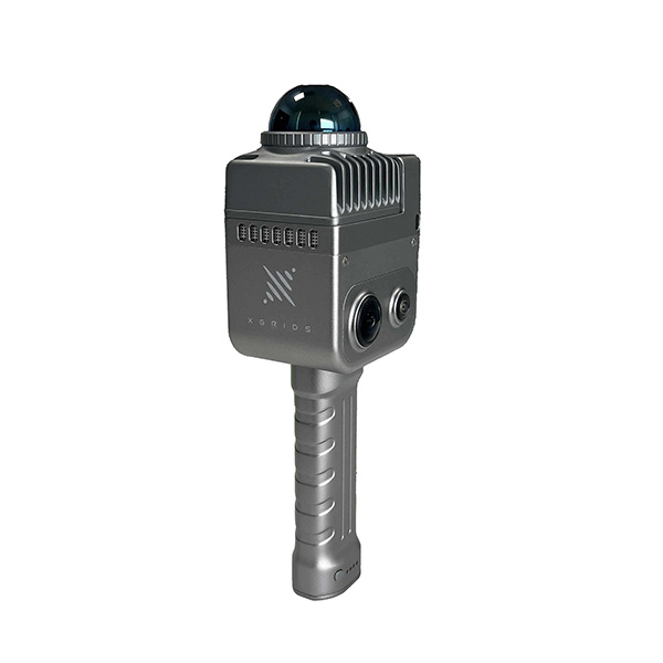
Compact & Lightweight Adopting the aluminum alloy material for K1's body, makes its weight only 1kg including the battery, extremely light and convenient to carry, easier for work. Multi-line lidar, panoramic collection, no omissions Equipped with a 40-line lidar with a point rate of 200,000 points/sec, 360° laser horizontal FOV, capturing richer details of objects and no omissions for scanning. Moreover, the ±1.2cm accuracy and 40m measurement distance can meet the demands of the most scenes.
LIXEL K1 WITH 2 BATTERIES |
SPECIFICATION
Power input | 14.4V |
Power consumption | <20W |
Weight | 1kg |
Data interface | USB3.l Gen2 |
Storage capacity | TF card 256G ( Replacable) |
Connection mode | Wi-Fi/Bluetooth |
Operating temperature | -20°C~50°C |
Protection level | IP54 |
Product shell | Navigational Aluminium |
Power supply | Fast-lock battery/external power |
Operating time | 1.5h |
Batter capacity | 28.8whv |
number of cameras | 4 |
Visual-Aided Positioning | Supported |
APP Wi-Fi distance | 20m |
RTK module | Supported |
DATA & STORAGE
Calculating mode | Real-time calculating/Mixed calculating |
Calculating software | Lixl studio post-processing software for Win |
Point cloud format | Las |
Color point cloud | Supported |
SCAN PERORMANCE
Laser lines | 40 |
Laser class | ClassI/905nm |
Relative accuracy | 1.2cm |
Absolute Accuracy | 3cm |
Repeat accuracy | 2cm |
Horizontal Accuracy | 0.015° |
Working range | 0.1 m~40m@l 0%,70m@80% |
LiDar FOV | 360°*-7 ~+52° |
Scan mode | Mobile |
Scan speed | 200,000 points/s |
Resume scanning from breakpoint | Supported |
VISUAL MODULE
Camera FOV | Color panorama HDV 360°*360° |
Camera resolution | 56million |